3 US Army Map Service 1943 AIRFIELD SURVEY Quadrangles Itasca County Minnesota For Sale


When you click on links to various merchants on this site and make a purchase, this can result in this site earning a commission. Affiliate programs and affiliations include, but are not limited to, the eBay Partner Network.

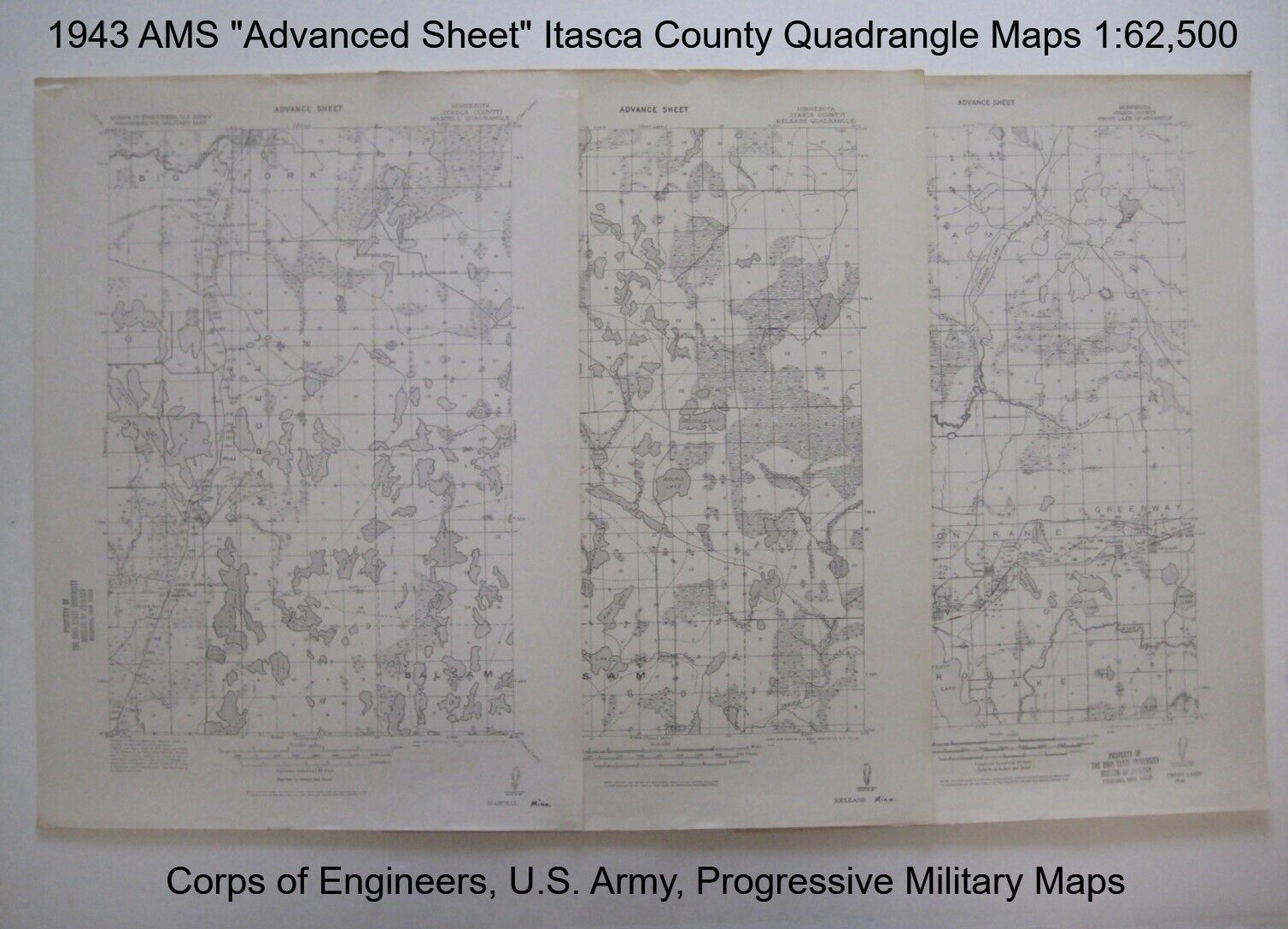
3 US Army Map Service 1943 AIRFIELD SURVEY Quadrangles Itasca County Minnesota:
$69.99
Three original 1943 topographic quadrangle maps prepared by the ArmyMap Service. - These maps are drawn on ascale of 1:62,000, and showcompleted and proposed roads, trails, railroads, cities, township andrange lines,rivers, lakes, and elevations in three Itasca County quadrangles.
- Each map measures 22" x 16" and is labeled in the uppermargin:"Advance Sheet, Corps of Engineers, U.S. Army, Progressive MilitaryMap;" along with the title of the quadrangle:
- TROUT LAKE; coverage area bounded by longitude93°15' W to 93°30'Wand latitude 47°15' N to 47°30' N.
- MARCELL; coverage area bounded by longitude 93°30'W to 93°45'Wand latitude 47°30' N to 47°45' N.
- RELEASE; coverage area bounded by longitude 93°15'W to 93°30'Wand latitude 47°30' N to 4°45' N.
- Each of the mapsis dated in the lower margin: Army Map Service, U.S.Army,Washington, D.C., three maps are in excellent condition, brightand clean, with no rips or tears. They areex-library maps,and there are old library stamps in the margin. They are blank onthe back, with no printing on the reverse side. Please see thescansand feelfree to ask any questions.
- The maps have never been folded, and we will shipthem toyoucarefully rolled in a sturdycardboard tube.
- These are original, authentic 1943 U.S. Army MapService quadrangles, notreproductions or modern reprints, and are fully guaranteed to begenuine.
- Between 1941 and 1968, the Army Map Service wasresponsible for thepublication and distribution of military topographic maps for use byU.S. military forces. Created from a merger of the EngineerReproduction Plant and the Army's Geographic Section, the AMS operatedunder the U.S. Army Corps of Engineers.
- During World War II, the United States Army AirForces(USAAF) established numerous airfields in Minnesota for training pilotsandaircrews of USAAF fighters and bombers. These three maps were amongthose compiledby the Army Map Service to aid in airfield construction and provideinformationon approachesfor aeronautical navigators, with details on land features and data onelevations.
- Buy with confidence! We are always happy to combineshipping on thepurchase of multiple items — just make sure to pay for everythingat one time, not individually.
Powered by SixBit's eCommerce Solution 
|
|
Other Related Items:
Related Items:
3x5ft US American Flag Heavy Duty Embroidered Stars Sewn Stripes Grommets Oxford $15.88

US ARMY ACU ASSAULT PACK 3 DAY MOLLE II BACKPACK Made in USA with Stiffiner $34.90

3x5ft US American Flag Heavy Duty Embroidered Stars Sewn Stripes Grommets Oxford $11.99
|


